Brussels has a duplicate image problem, and it did not happen overnight. The urban documentation archive maintained by Brussels Mobility and the urban planning directorate Urban Brussels — formally known as Perspective Brussels — now holds tens of thousands of street-level photographs that were captured, catalogued, and then inadvertently captured again by successive digitisation drives stretching back to 2014. The result is a municipal visual record that costs real money to store, slows down planning workflows, and has quietly frustrated architects, heritage surveyors, and urban planners working across the 19 communes for years.
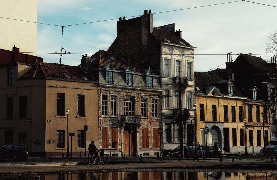
The timing matters. With Brussels set to revise its Good Living Environment ordinance — the Règlement Régional d'Urbanisme — before the end of 2026, planners and heritage bodies need clean, reliable image datasets to assess existing building stock, support permit reviews, and model streetscape changes. Redundant files are not merely a tidy-desk problem; they create version-control failures where an outdated photograph of, say, the Chaussée d'Ixelles or the Place Flagey precinct is pulled instead of a current one, leading to planning assessments based on stale visual evidence.
How the Archive Got This Way
The duplication traces to at least three distinct digitisation campaigns that were never properly synchronised. The first wave, launched around 2014 by the former Brussels Capital-Region urban documentation service, produced georeferenced street photographs indexed by commune and parcel number. A second campaign commissioned between 2018 and 2020 — partly funded under the European Regional Development Fund's urban innovation strand — re-photographed priority zones including the Pentagon neighbourhood, the canal corridor from Molenbeek to Anderlecht, and the lower town around the Sainte-Catherine district. A third pass, conducted in 2022 and 2023 specifically to document post-Covid commercial vacancy rates on major retail axes including the Rue Neuve and the Rue du Midi, added another layer.
Each campaign used different file-naming conventions, different metadata schemas, and in some cases different contracted service providers. When Perspective Brussels attempted to consolidate the collections into its UrbIS spatial data platform in late 2023, the merge produced what internal working documents — seen by planning consultants who have publicly discussed the issue at Urban Brussels stakeholder sessions — described as significant duplication across parcel-linked image sets. Estimates circulating in the urban planning sector put the proportion of duplicate or near-duplicate files at somewhere between 25 and 40 percent of the merged collection, though no official figure has been published.
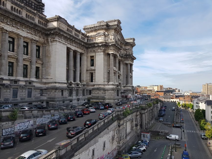
Storage is not cheap. Commercial cloud archiving for high-resolution georeferenced image sets runs at roughly €0.02 to €0.04 per gigabyte per month at current European market rates, and a collection of this scale — professional urban surveys generate file sizes in the tens of terabytes — adds up. Beyond cost, the practical drag is significant: Brussels Environment's heritage survey team, which uses the archive when assessing listed and near-listed buildings in areas like Ixelles's Squares neighbourhood and Saint-Gilles's Art Nouveau belt, has reportedly had to build manual verification steps into its workflow specifically to guard against pulling the wrong image version.
What Comes Next
Perspective Brussels confirmed earlier this year that it is piloting automated duplicate-detection software on a subset of the UrbIS image library, with a phased rollout planned through the second half of 2026. The technology uses perceptual hashing — a method that compares image fingerprints rather than raw pixel data — to flag photographs taken from the same geolocation within a defined time window. Files flagged as duplicates are moved to a quarantine folder rather than deleted outright, preserving them until a human reviewer signs off.
For residents, neighbourhood associations, and small architectural practices that draw on the publicly accessible portion of the UrbIS portal, the practical advice is straightforward: when pulling street images for permit dossiers or heritage assessments, always check the capture date embedded in the image metadata and cross-reference with the commune-specific survey schedule published on the Perspective Brussels website. Images tagged before January 2022 in the Pentagon and canal zones are the most likely to have a more recent twin sitting uncatalogued in the same archive. Cleaning that up is a slow job, but it is finally under way.